
We absolutely love sharing this photographer’s work.
Over the past few days, Twitter user @bioreconstruct has shot and posted a number of new and detailed aerial photos of Walt Disney World.
With that being said, let’s take a look at @bioreconstruct’s new aerial photos of Walt Disney World including the Magic Kingdom.
PLEASE NOTE: Original captions for the photos will be provided (find at the bottom of the article). This will allow you, the reader, to know what you are looking at. Additionally, click on the image to enlarge it.
Magic Kingdom


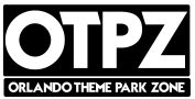
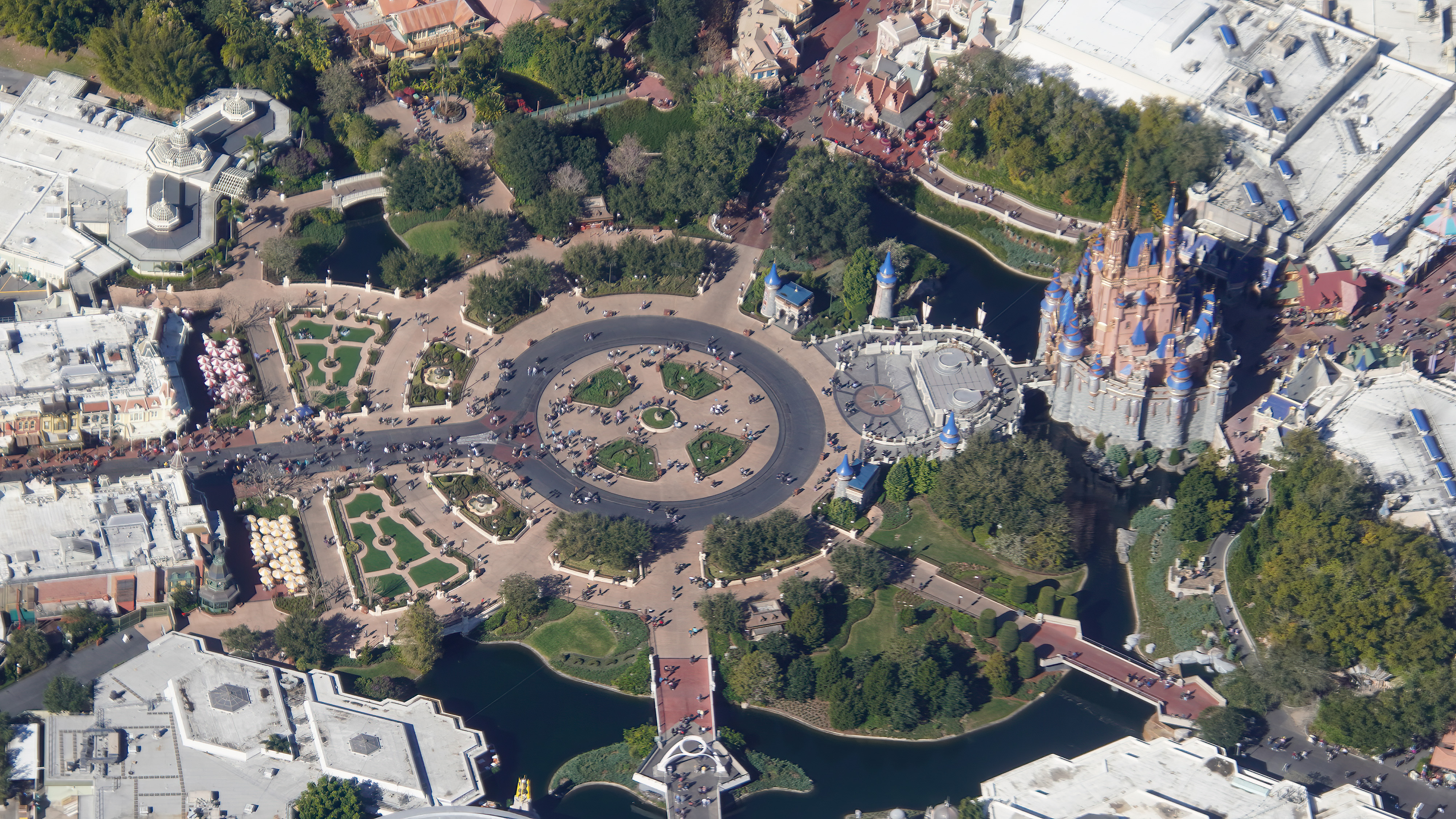
Main Street, U.S.A and Castle Hub – Magic Kingdom

Themed Lands at Magic Kingodm

Disney’s Hollywood Studios


Disney’s Animal Kingdom

Walt Disney World Water Parks
Disney’s Blizzard Beach
Disney’s Typhoon Lagoon

Disney Springs
Resort Hotels


Extra
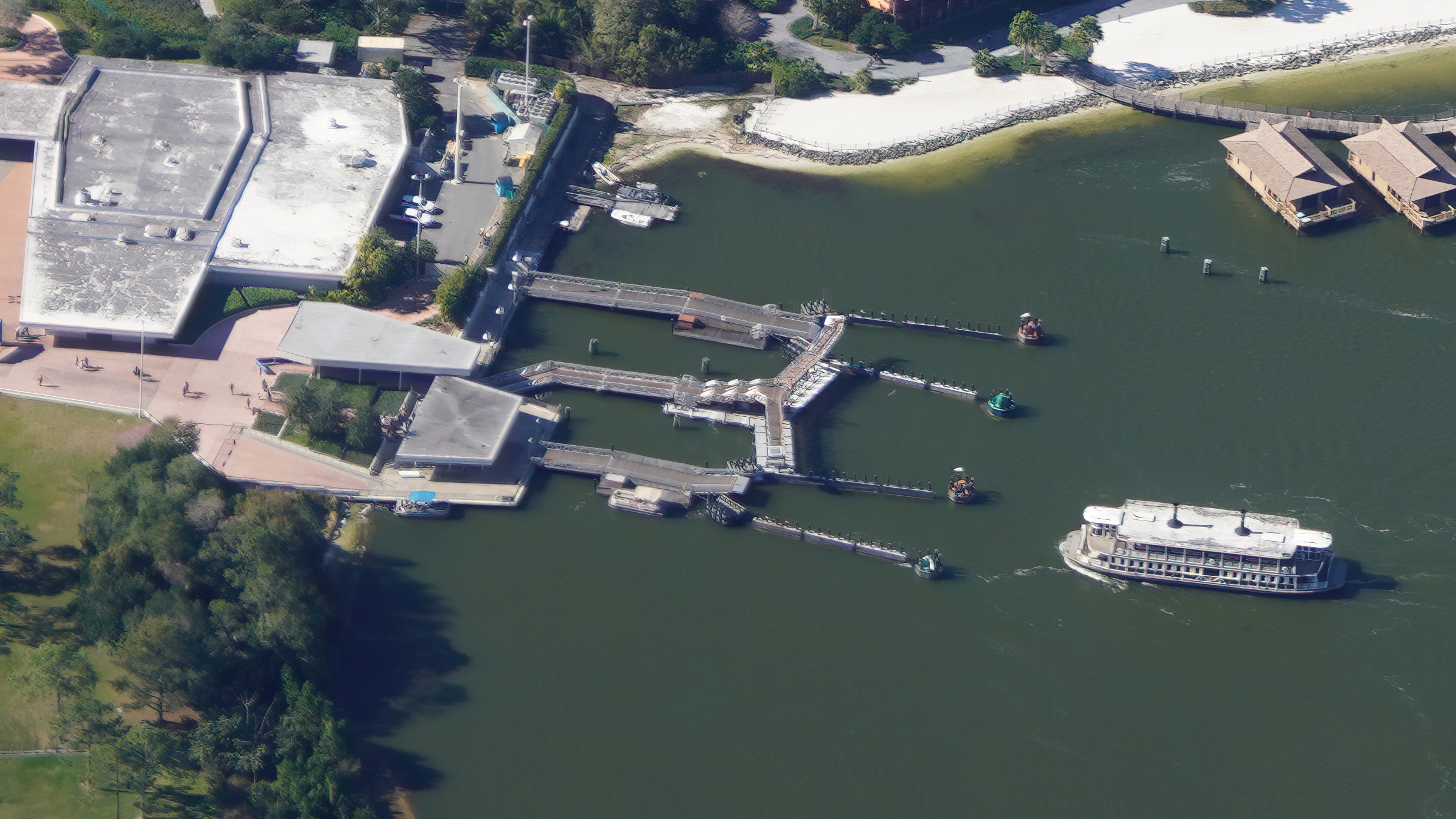

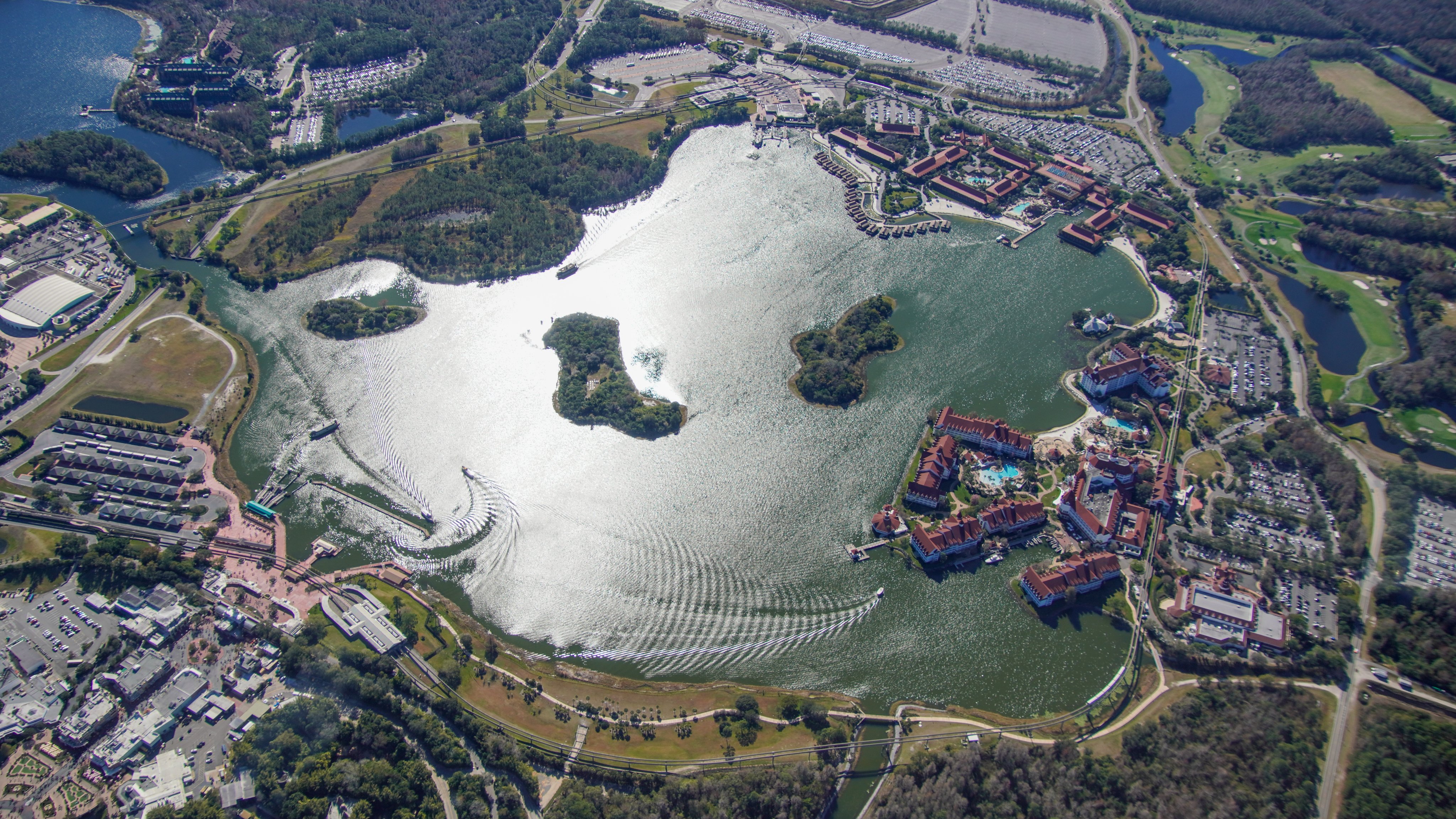
Photo Captions
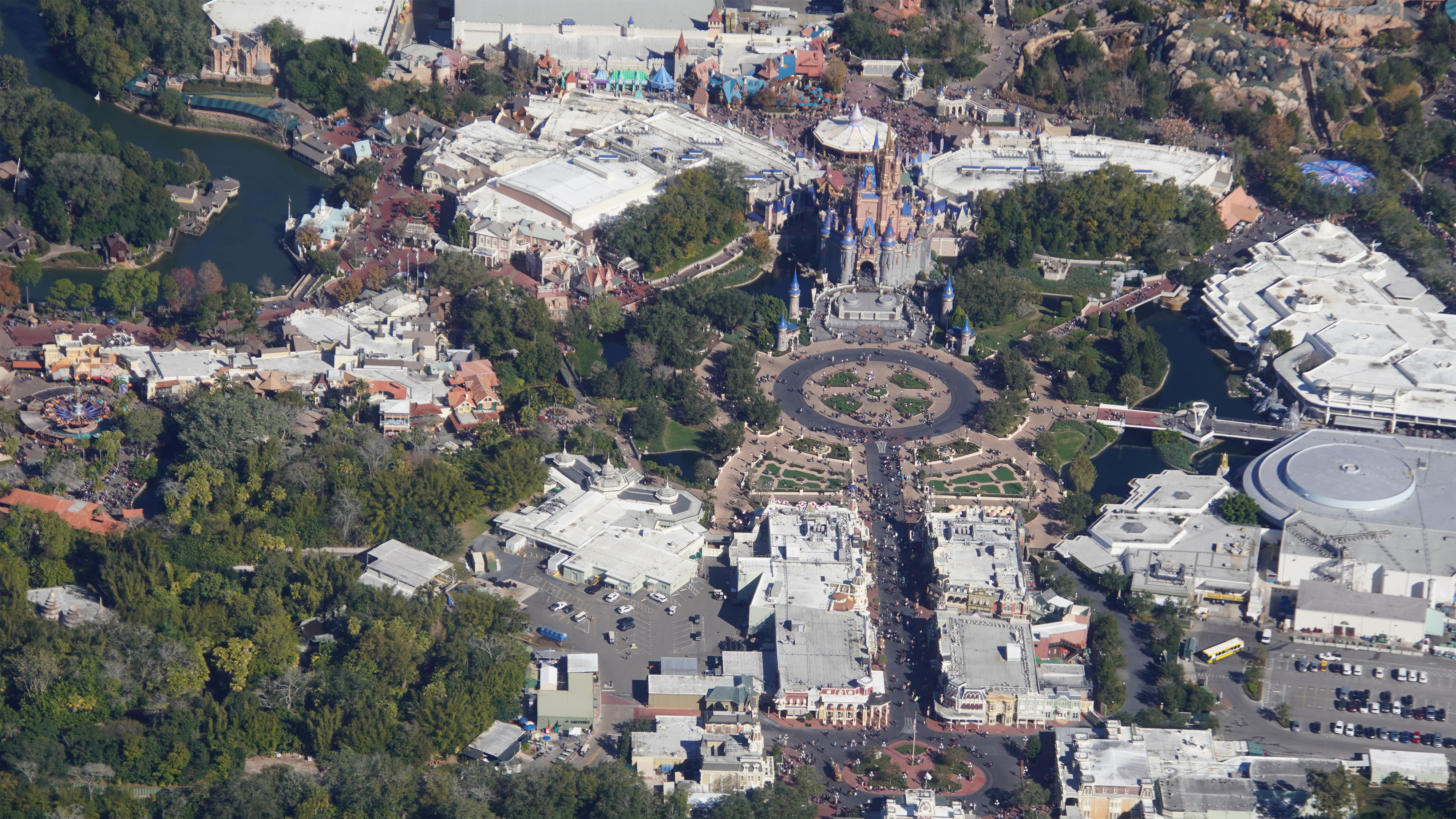
Magic Kingdom (MK)
- Image #1: Aerial overview of Magic Kingdom. Bottom right shows recently go-away-green painted walls along a pond. Right side of Main Street is a tree-lined bypass. Top left is a common route of #runDisney courses, for leaving the park. Courses enter through the bus loop.
- Image #2: Aerial overview (Jan 30) of Magic Kingdom.
- Image #3: Aerial look at Magic Kingdom.
- Image #4: Aerial overview of Magic Kingdom. Top center is the monorail roundhouse.
Main Street, U.S.A, and Castle Hub
- Image #5: Aerial look at Main Street USA and the Castle Hub. At left is the tree lined bypass used for entry to upcharge events like the Halloween parties. The bypass is also used on especially busy nights like New Years Eve.
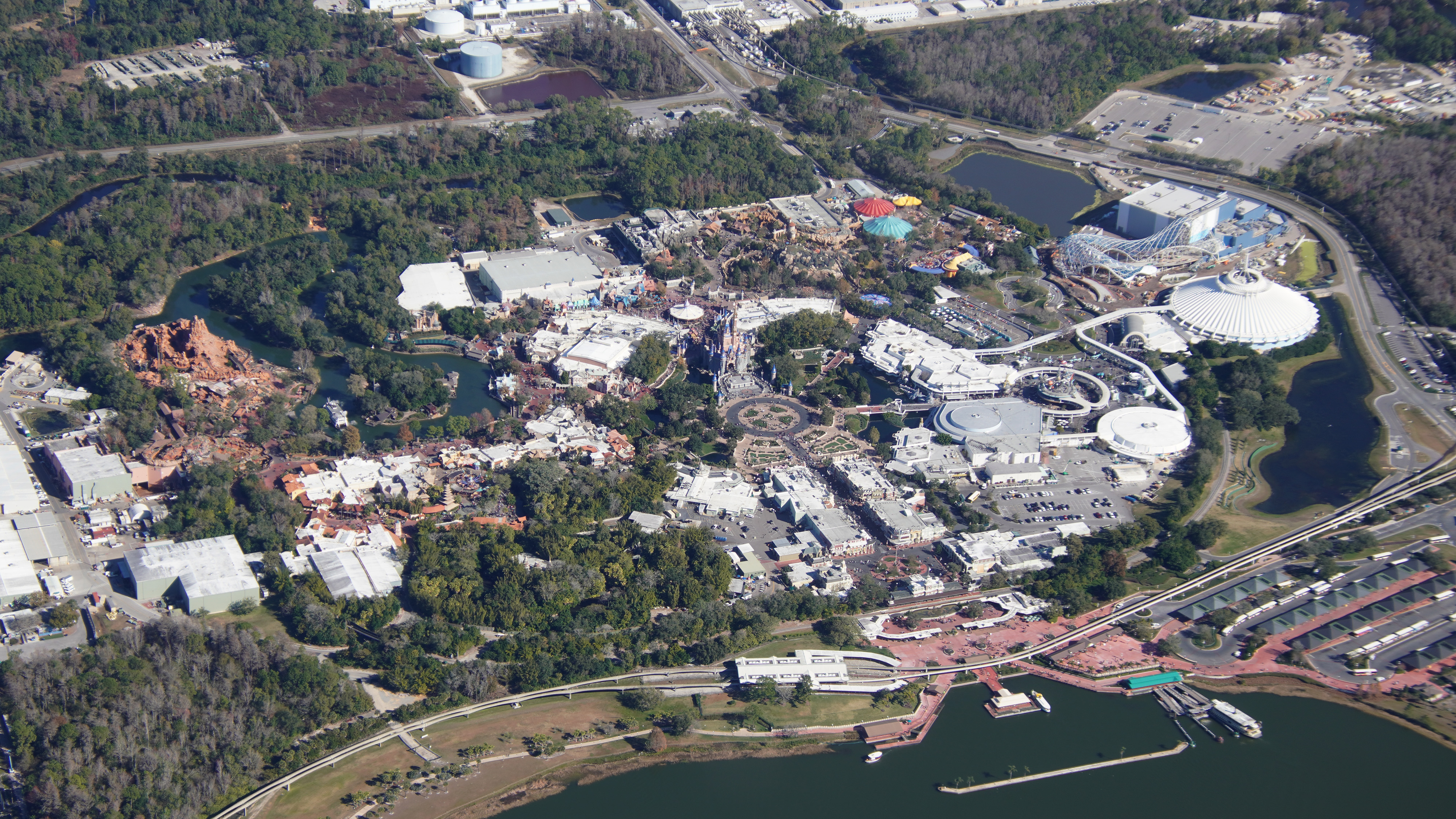
- Image #6: Aerial photo (Jan 30) of the MK hub and Cinderella Castle.
- Image #7: Aerial photo of Cinderella Castle.
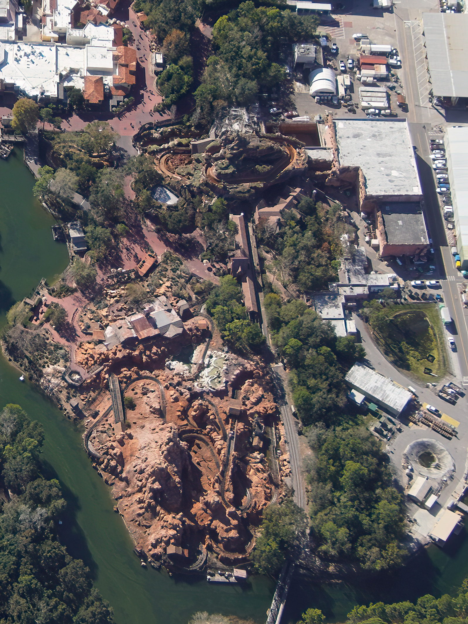
Themed Lands
- Image #8: Aerial look at Big Thunder Mountain Railroad. Nearby is Splash Mountain, drained for refurbishment. Road at right is a common water stop location in #runDisney courses through Magic Kingdom.
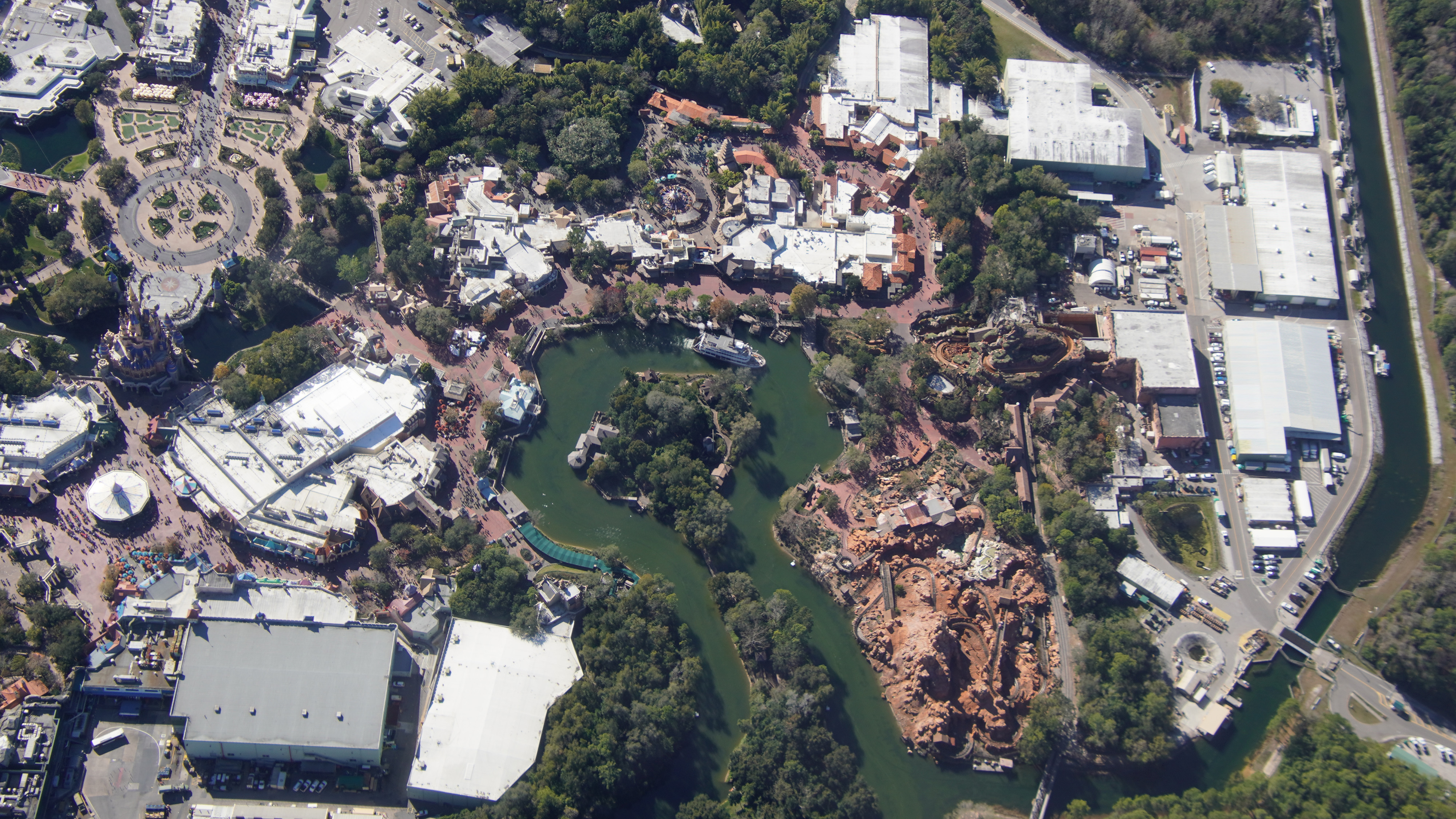
- Image #9: Aerial look at Rivers of America, Big Thunder, and Splash Mountain (in refurbishment). Show building in top left is Haunted Mansion.
- Image #10: Aerial look at West side of Magic Kingdom. Including Liberty Square, Frontierland, and Adventureland.
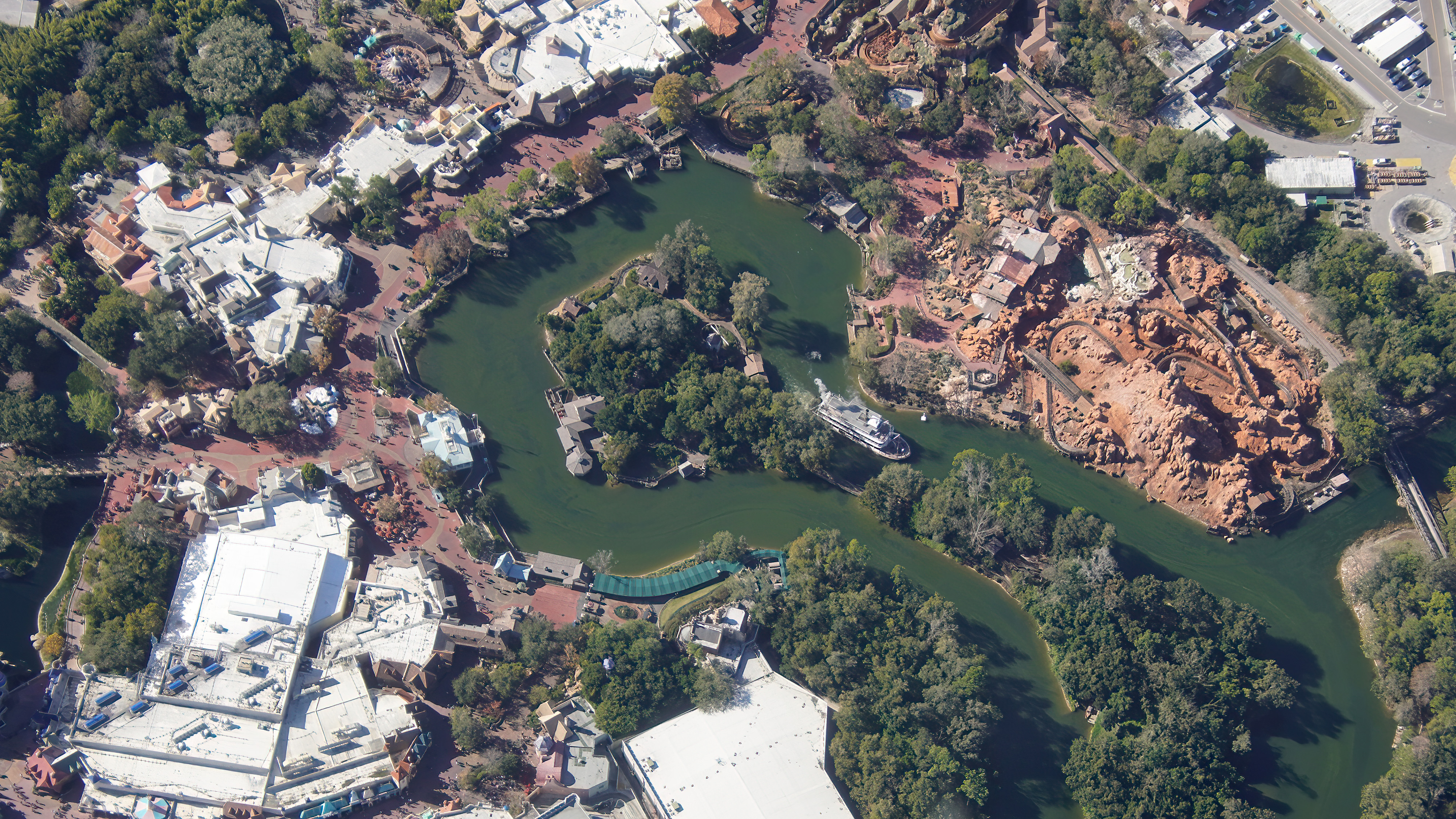
- Image #11: Aerial look at Liberty Square, Rivers of America, and Frontierland.
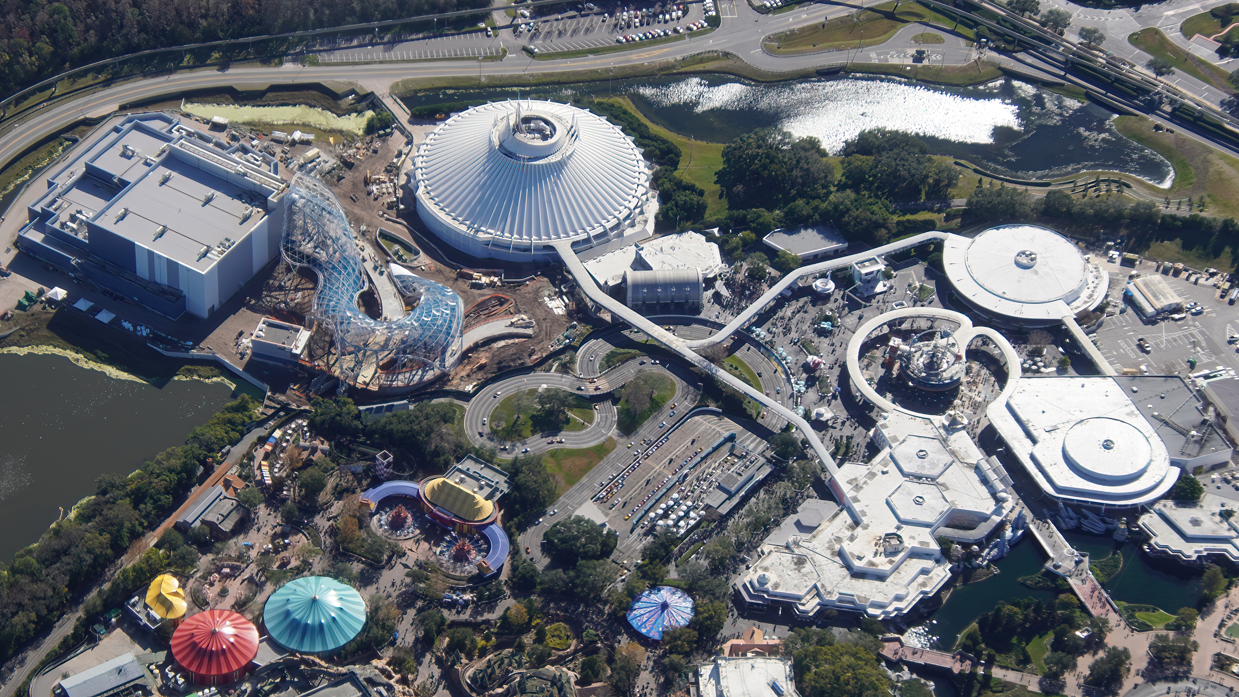
- Image #12: Aerial overview of Tomorrowland.
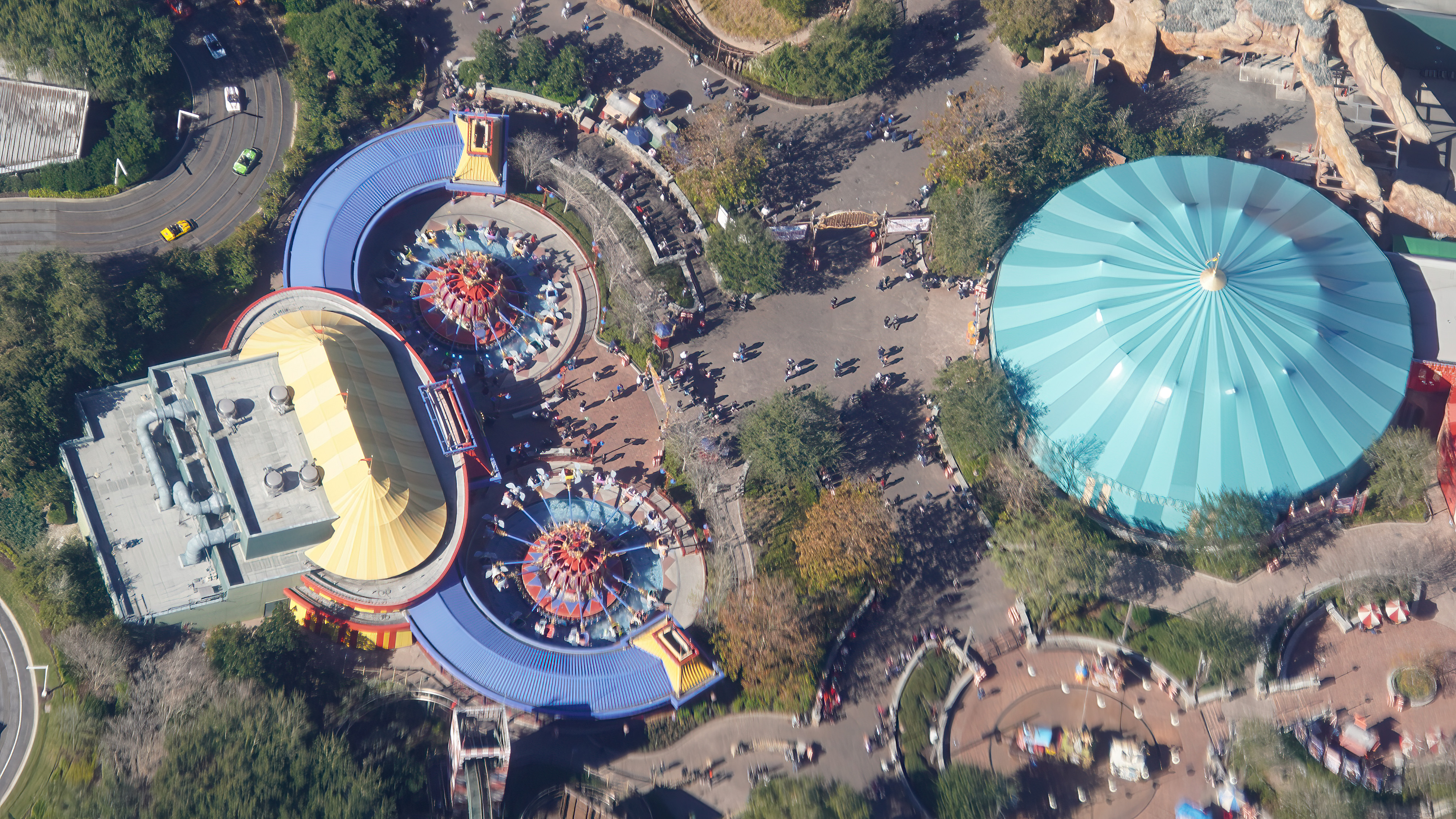
- Image #13: Near straight down aerial look at Dumbo the Flying Elephant.
Hollywood Studios
- Image #14: Aerial overview of Disney’s Hollywood Studios. Opening in March is Star Wars Galactic Starcruiser hotel, at top center.
- Image #15: Aerial overview of Disney’s Hollywood Studios.
Animal Kingdom
- Image #16: Aerial overview (Jan 30) of Animal Kingdom.
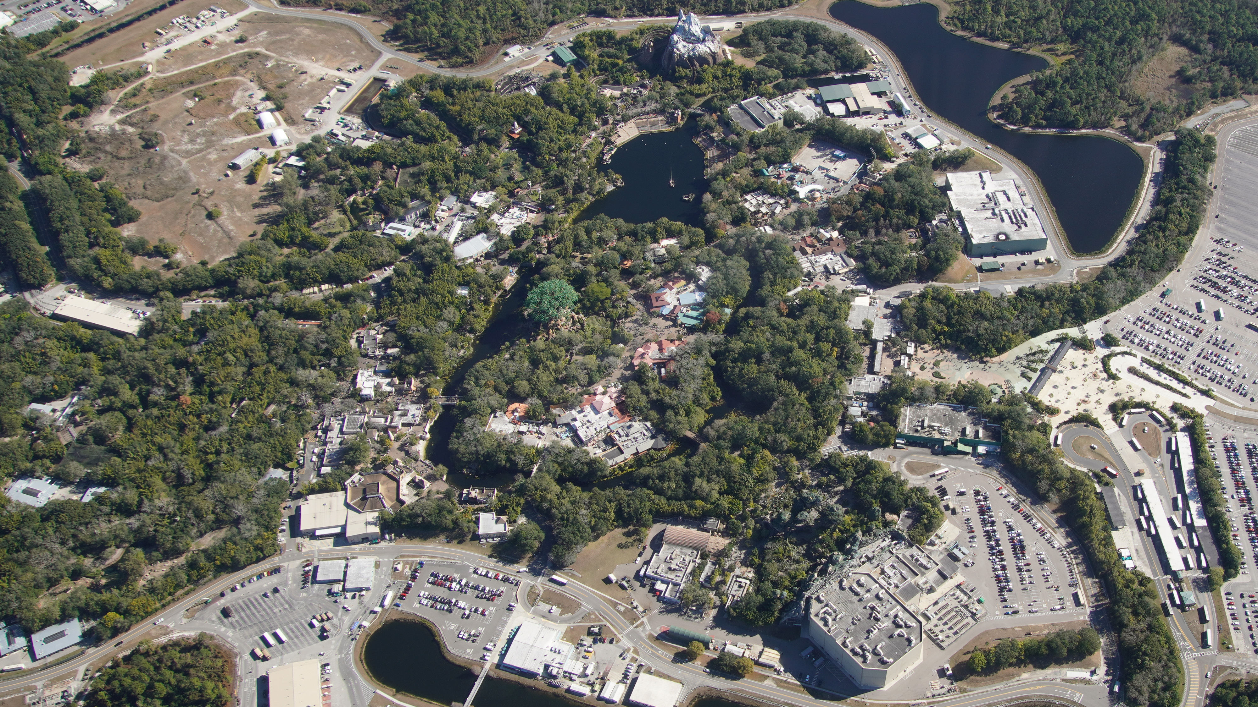
- Image #17: Aerial overview of Disney’s largest park. Animal Kingdom.
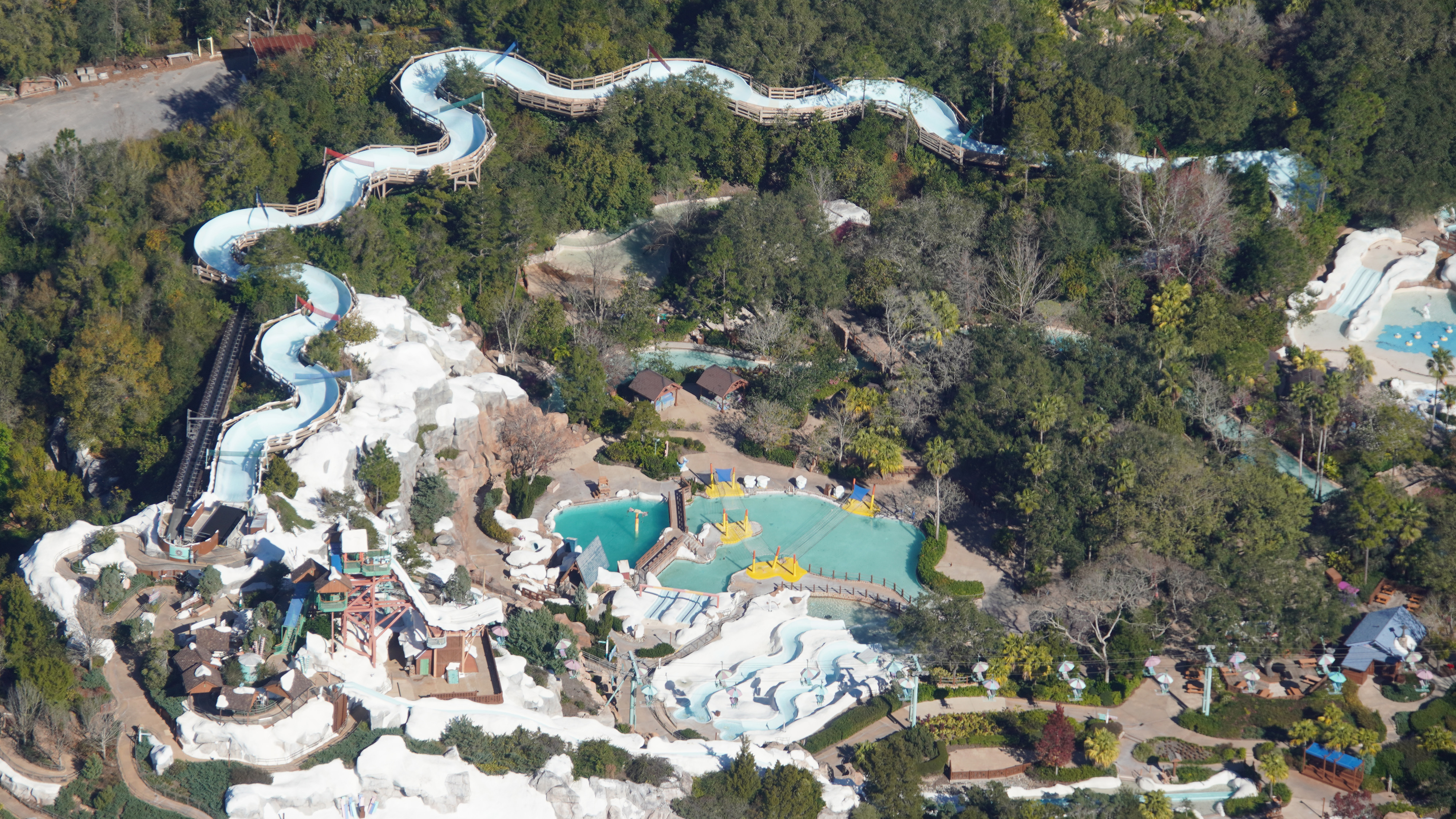
Blizzard Beach
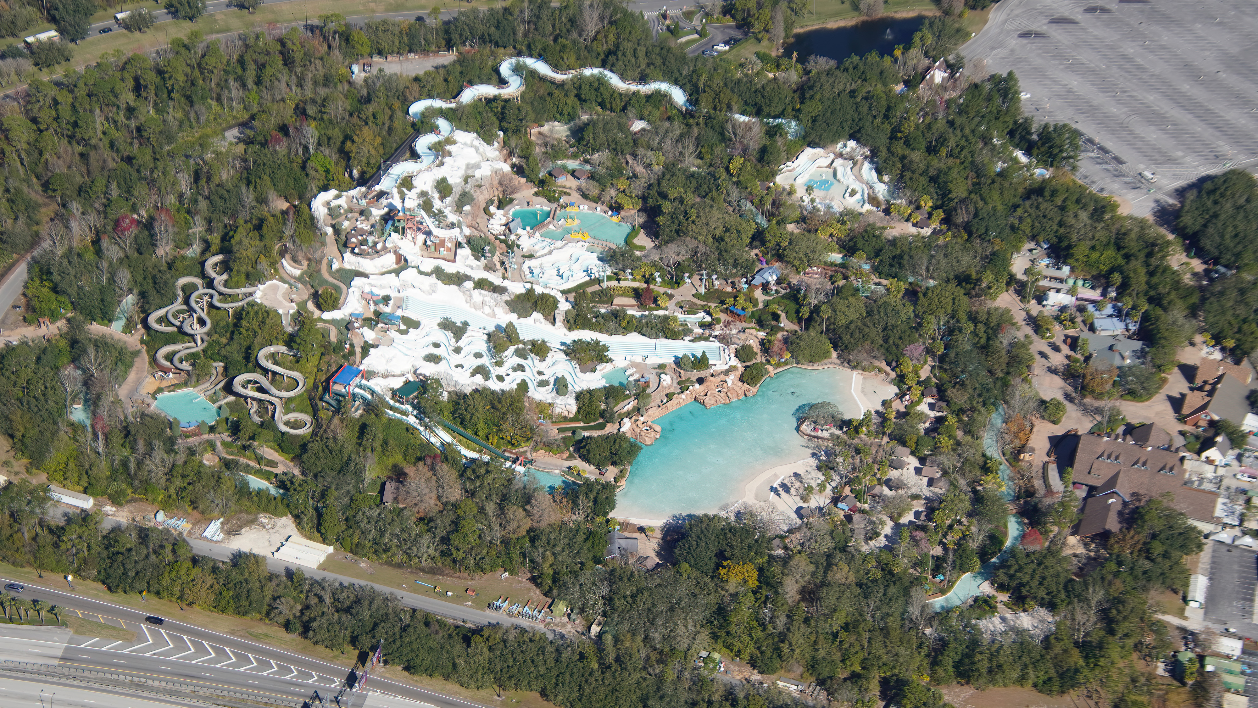
- Image #18: Aerial photo of Blizzard Beach. Closed for refurbishment.
- Image #19: Aerial look at some of the attractions in Blizzard Beach. Photo Jan 30. Water park is closed for refurbishment.
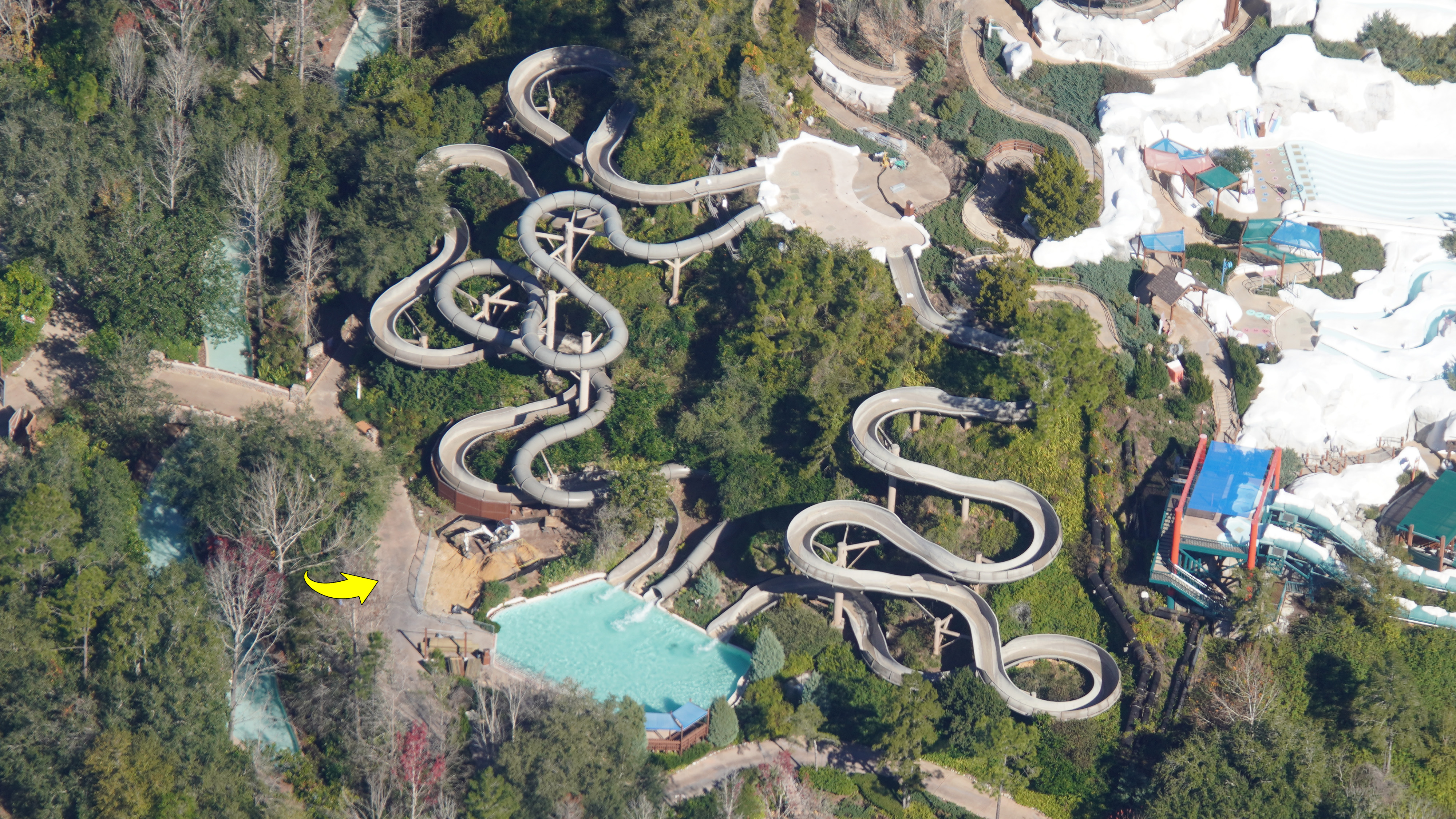
- Image #20: Aerial look (Jan 30) at an excavator next to Runoff Rapids in Blizzard Beach. Water park is closed for refurbishment.
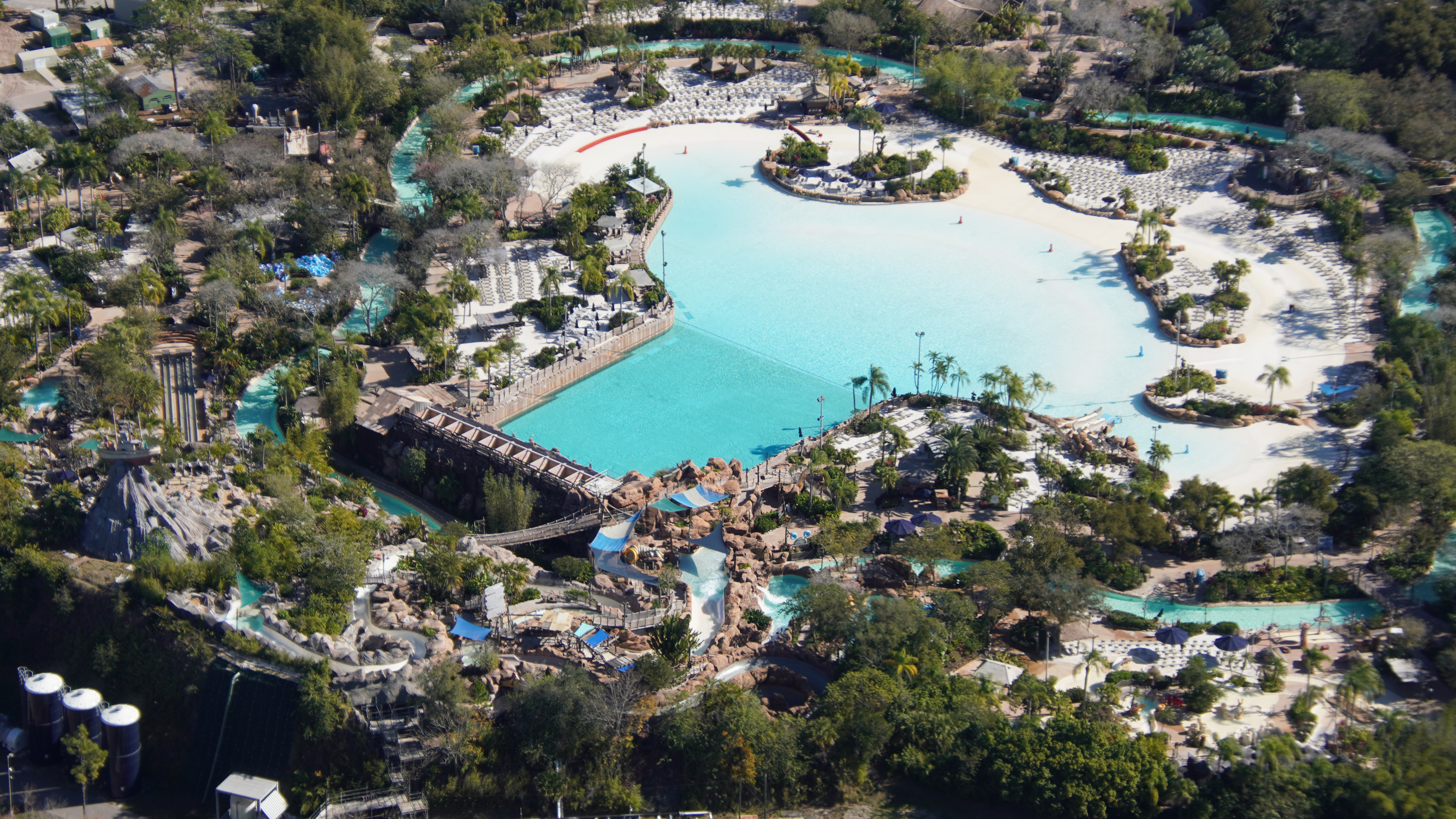
Typhoon Lagoon
- Image #21: Aerial overview of Typhoon Lagoon. Seen here closed on Jan 30 due to inclement weather.
- Image #22: Aerial photo of Typhoon Lagoon. Closed (Jan 30) due to inclement weather.
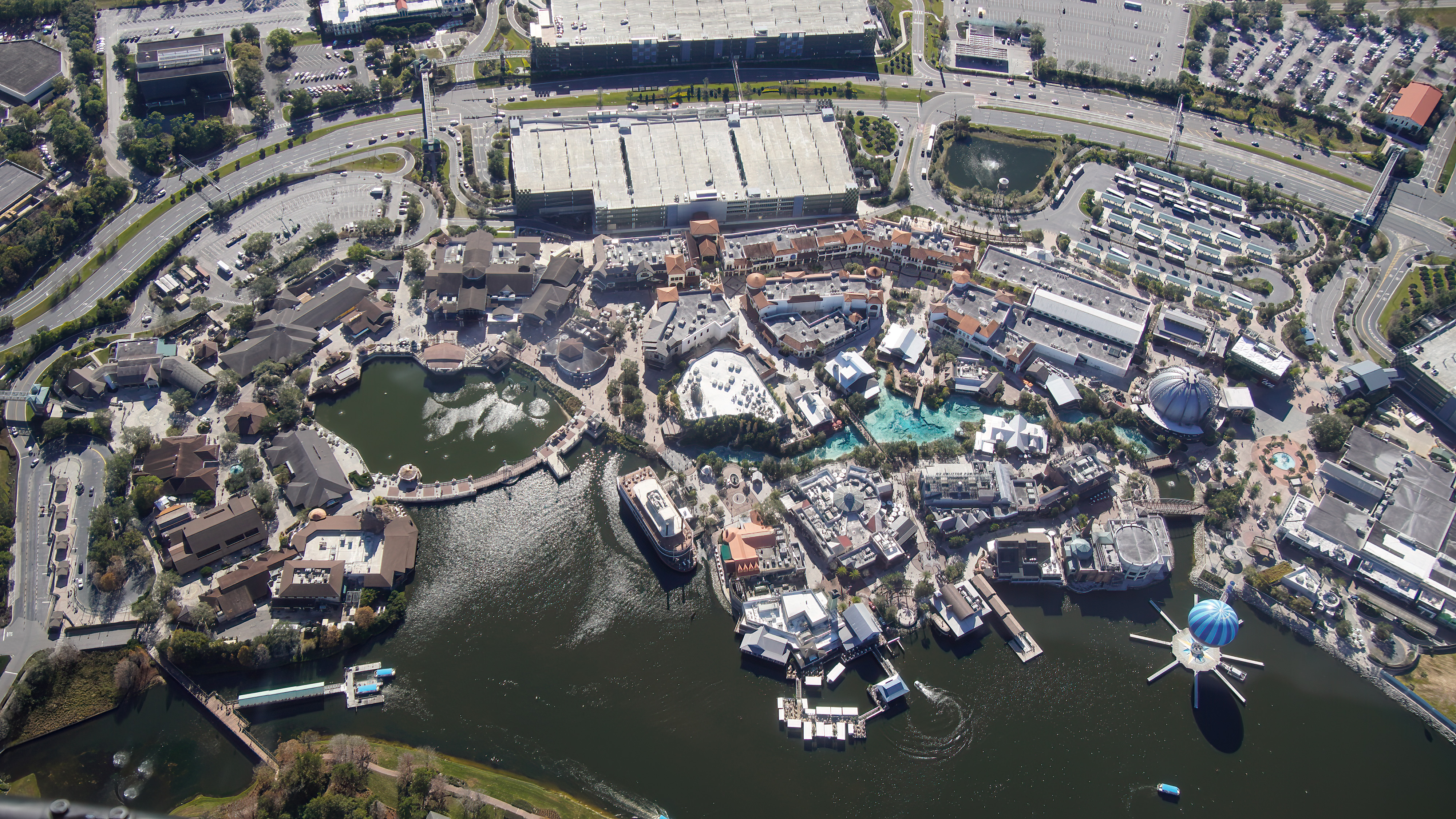
Disney Springs
- Image #23: Nearly straight-down aerial photo of much of Disney Springs (Jan 30). There’s a line of cars entering the Lime parking garage.
Resort Hotels
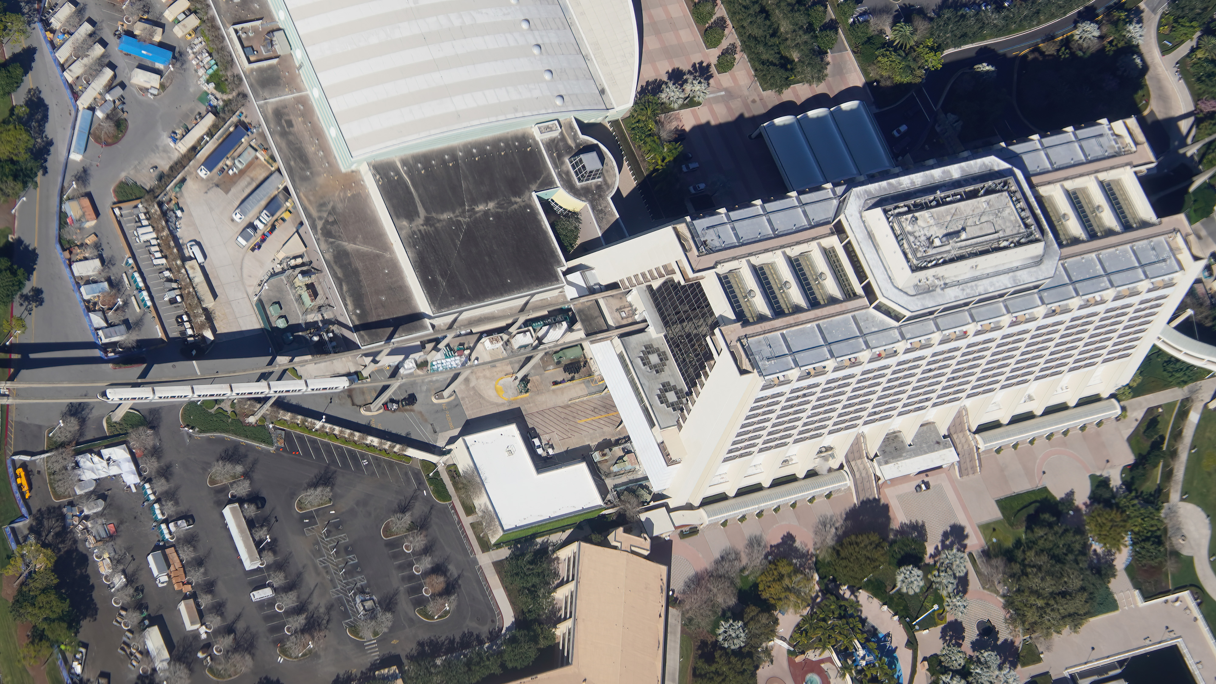
- Image #24: Almost straight-down aerial look (Jan 30) at Monorail Black approaching Contemporary Resort.
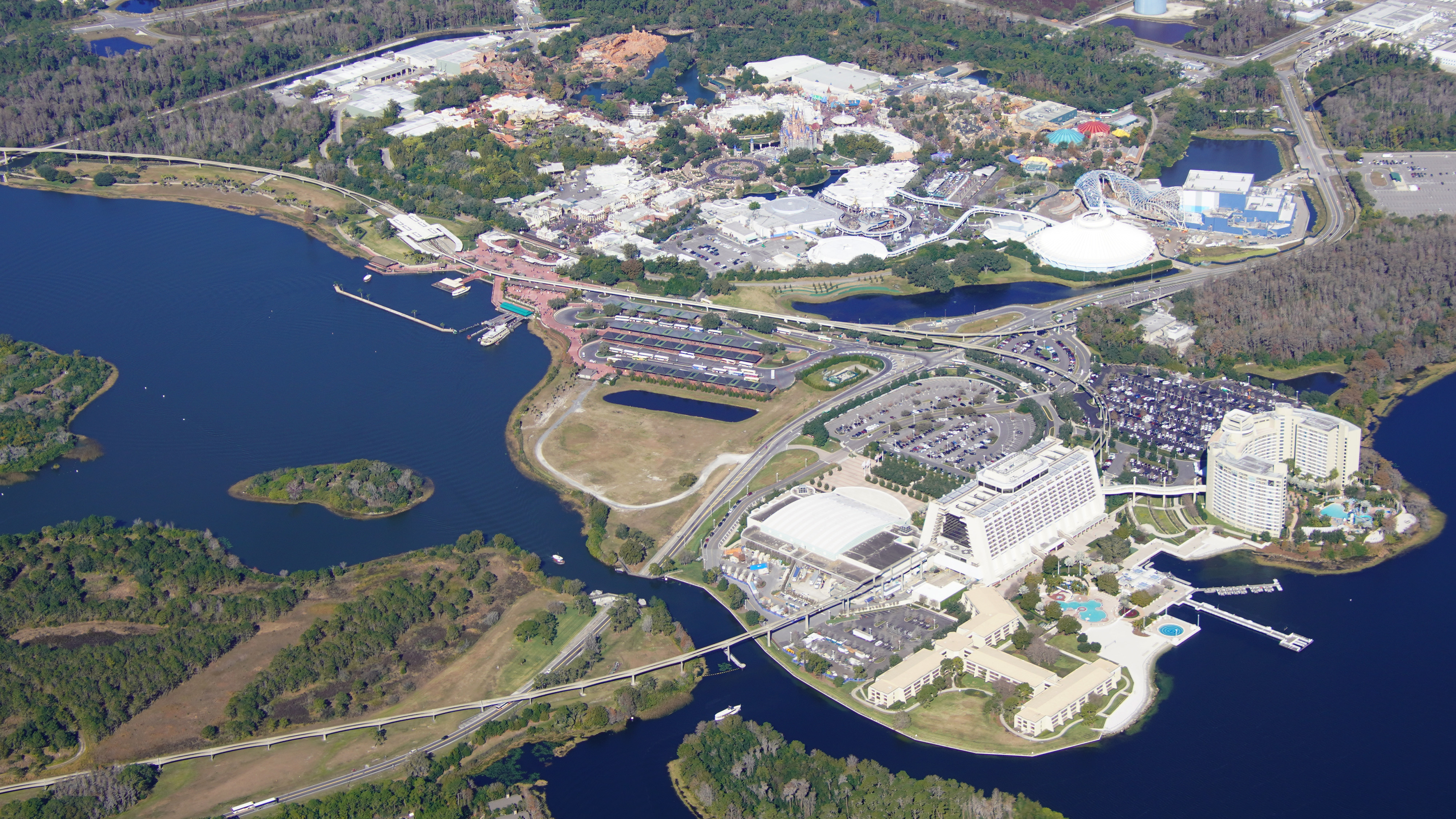
- Image #25: Aerial look (Jan 30) at Contemporary Resort and Magic Kingdom.
- Image #26: Aerial photo (Jan 30) of Coronado Springs.
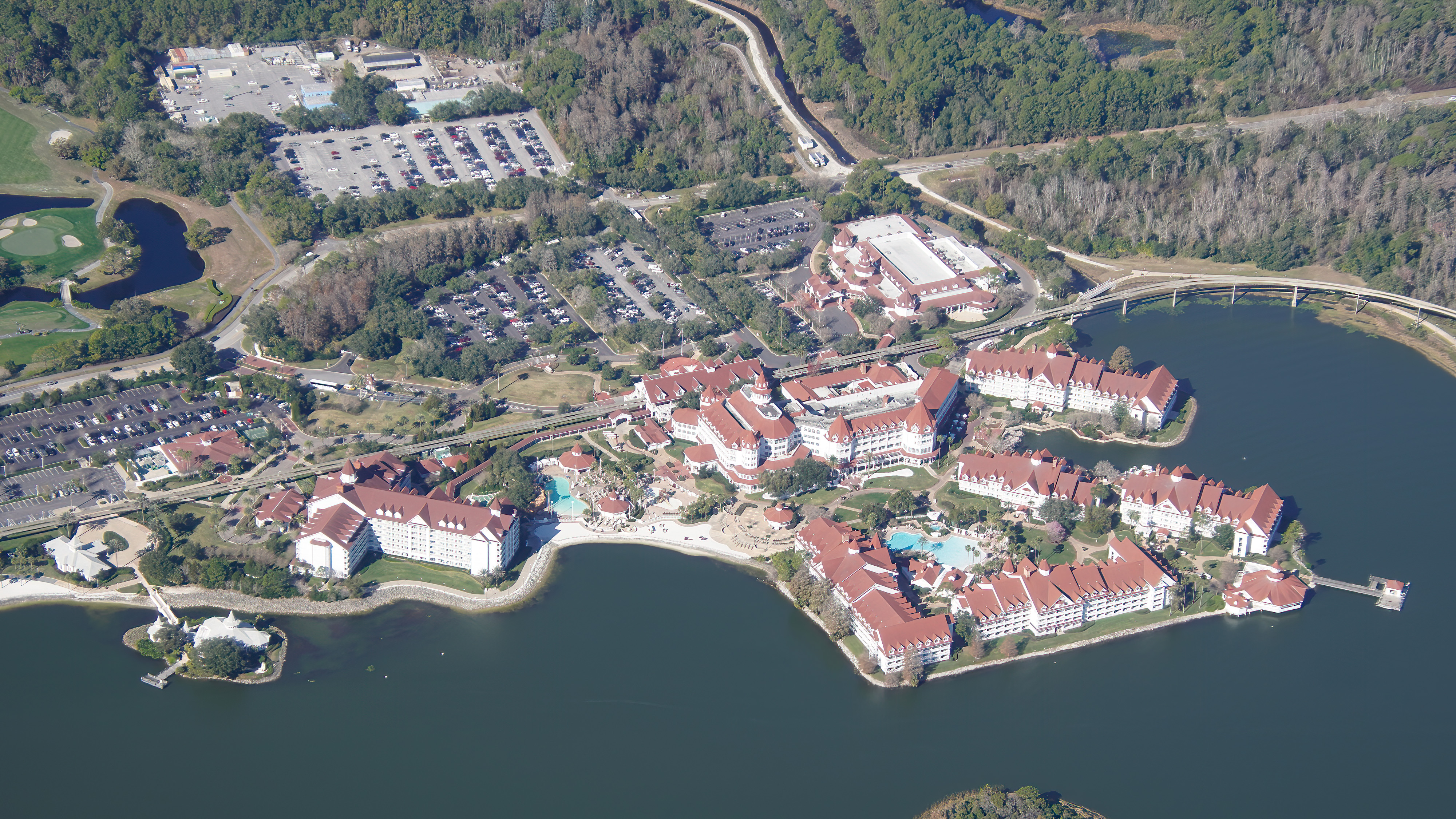
- Image #27: Aerial overview (Jan 30) of Grand Floridian and Disney Wedding Pavilion.
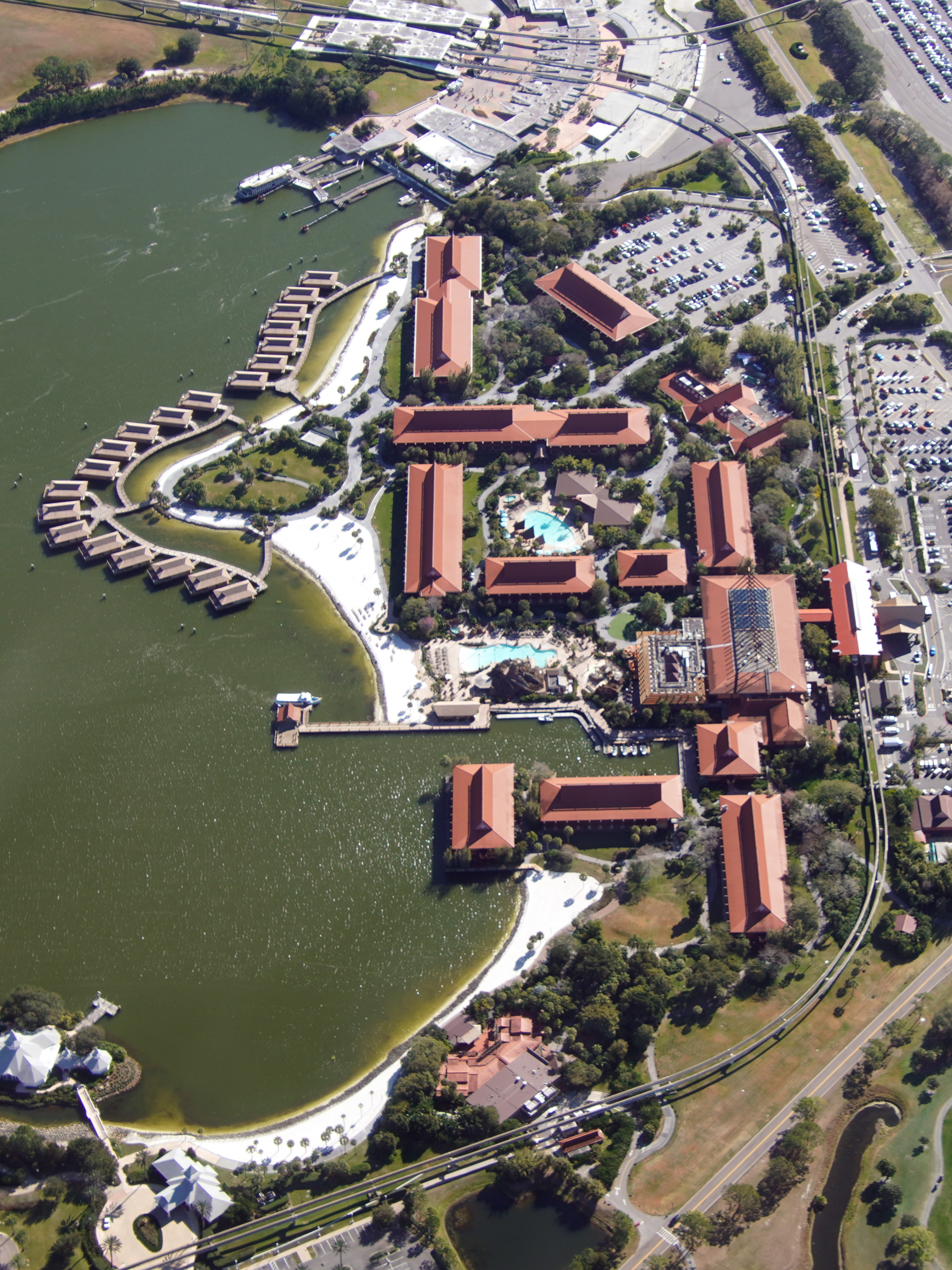
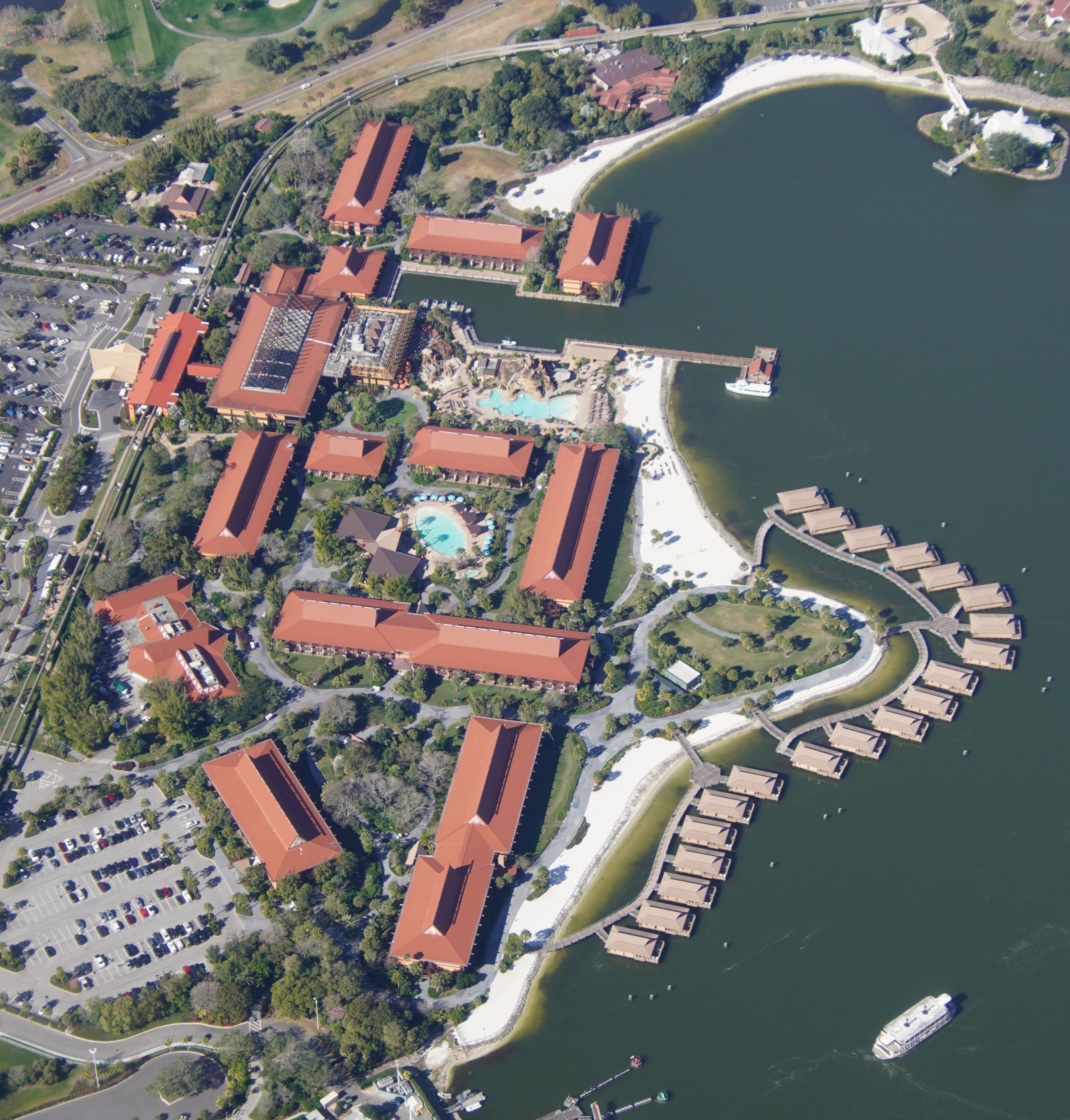
- Image #28: Aerial overview of Polynesian Resort.
- Image #29: Aerial overview of Polynesian Resort.
- Image #30: Aerial overview of EPCOT Resorts. There are actually 2 roads passing under water at International Gateway. (Bottom center of photo.) One is the EPCOT perimeter service road. The other is a guest road for the resorts.
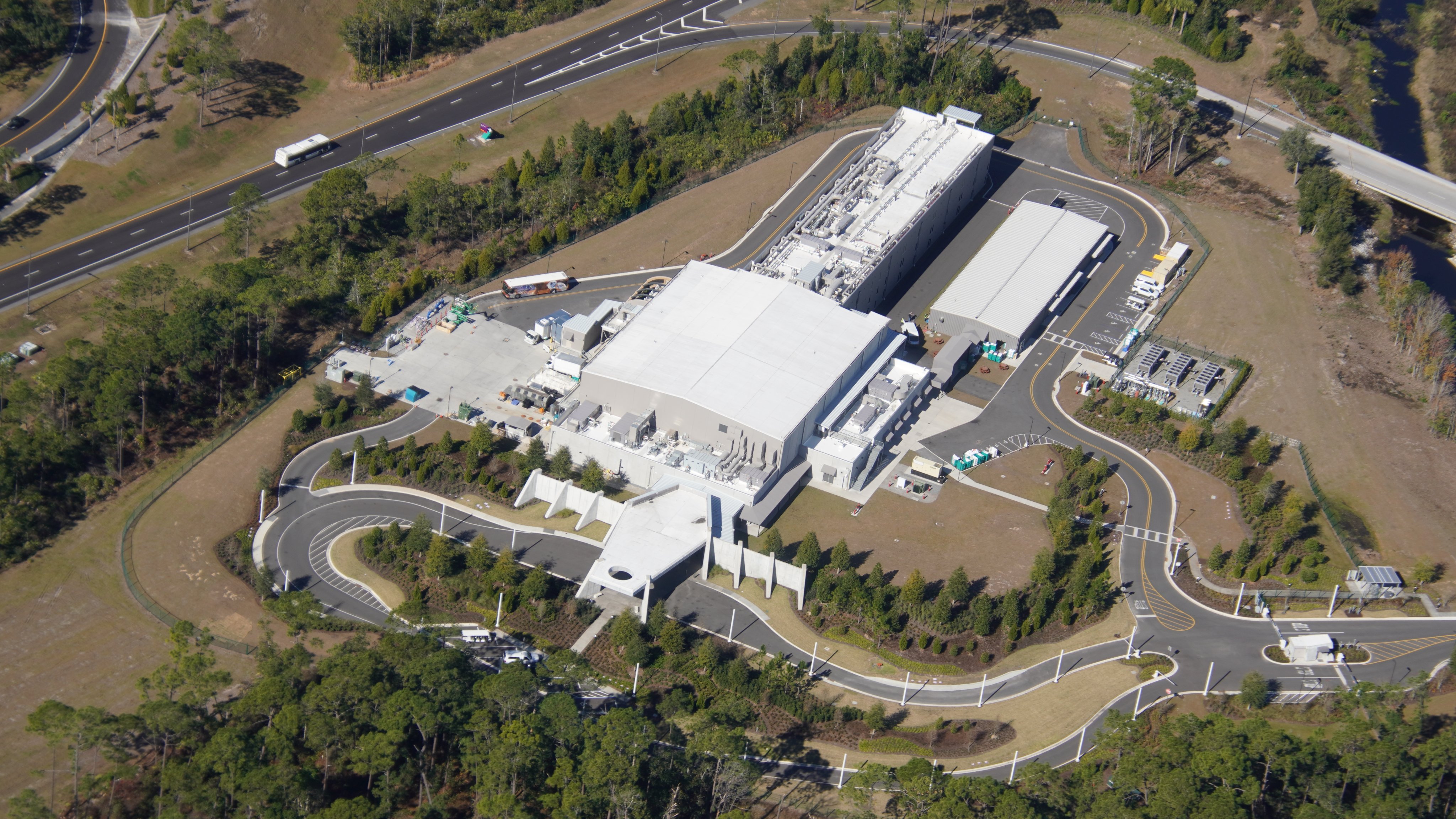
- Image #31: Aerial overview of Star Wars Galactic Starcruiser hotel. The large square has decks of the ship, cabins are in long building in back. 2 day mock cruise. Fully realized Star Wars movie sets. Early arriving guests are directed to Disney Springs, using the bus seen staged at left.
Extra
- Image #32: Aerial look at the TTC ferry dock, with recently added ramps for direct access of the upper deck.
- Image #33: One of the Walt Disney World property lines is in foreground. Line of trees between Bonnet Creek Resort and Caribbean Beach/Pop Century. Can you trace the West side property on the horizon of this aerial photo?*
- Image #34: In this aerial overview of Seven Seas Lagoon from 3100 feet you can trace the walkway between Magic Kingdom and Grand Floridian. It’s hard to gauge from monorail how large the site is between Contemporary and TTC. Interesting wave patterns from boats.
*Let us know in the comments below whether you were able to trace the West side property.
Stay tuned to Orlando Theme Park Zone for more Orlando theme park-related news and information.


